About Aetheris
Precision Data. Elevated Decisions.
We build the aerial-data layer that enterprise operators need to triage risk, document condition, and make defensible decisions about physical assets.
Our mission
Make aerial intelligence the default for asset decisions.
To deliver survey-grade aerial intelligence that transforms how businesses in the Four State area operate — making the same data infrastructure that powers Fortune 500 operations accessible to the contractors, facility managers, and field operators who drive the regional economy.
Every inspection generates a measurement event. The industry has spent decades treating those events as photographs in PDFs. Aetheris treats them as structured data — scored, comparable across time, queryable across portfolios, defensible at audit time.
Our methodology aligns with ASTM E2018-24 for property condition assessment and ANSI/ASSP Z590.3, ISO 31000, and OSHA guidance for risk classification. That alignment is what turns a flight into a defensible record.
We started Aetheris because the gap between enterprise-grade aerial intelligence and what’s available to regional businesses shouldn’t be as wide as it is. A roofing contractor in Springfield deserves the same data quality as a Fortune 500 facility manager. A general contractor in Bentonville should have access to the same site intelligence tools that power billion-dollar infrastructure projects. We’re here to close that gap — not someday, but now, with every flight we fly and every report we deliver.
Our philosophy
How we operate.
The companies that win have the best data. Not the most data — the best. Every decision we support is grounded in photogrammetric measurement, not approximation. In an industry full of operators who fly cameras, we build data systems — structured, repeatable, defensible intelligence that gets more valuable with every inspection cycle.
We don’t chase volume. We don’t cut corners on processing to hit a price point. And we don’t deliver photo dumps disguised as inspection reports. If the data isn’t right — if the methodology isn’t defensible and the measurements aren’t verified — it doesn’t leave our pipeline. That’s not a marketing position. It’s how we operate.
Why local beats satellite
Why the future of asset intelligence is local, not satellite.
Legacy measurement platforms deliver historical snapshots — imagery captured months ago from satellites and fixed-wing aircraft at altitudes that can’t resolve the details that drive decisions. By the time a report reaches your desk, the property has weathered another season, the jobsite has advanced, and the data describes a condition that no longer exists.
Aetheris captures current-state intelligence at sub-centimeter resolution, on your timeline, with thermal and photogrammetric capabilities that altitude-based platforms cannot replicate. This isn’t an incremental improvement over what exists — it’s a fundamentally different category of data, delivered by a partner who understands your market because we live in it.
I built Aetheris because I believe the technology that’s transforming how the biggest companies in the world manage their assets shouldn’t be locked behind seven-figure contracts and enterprise sales teams. The same drone platforms, the same photogrammetric processing, the same thermal analytics that power facility management for Fortune 500 operations — all of it should be accessible to the roofing contractor running three crews in Springfield, the GC managing a build in Bentonville, the quarry operator tracking stockpiles outside Joplin.
I’ve spent my career in the Testing, Inspection, and Certification industry and commercial construction — work where precision isn’t optional and the data has to hold up when someone challenges it. That background shaped how I think about every deliverable that leaves our pipeline: if it’s not measured, verified, and defensible, it doesn’t ship.
What drives me is pretty simple. I care about quality — obsessively. I believe in technology as a force multiplier for the people doing real work. And I value relationships built on trust, not transactions. Every client engagement is a partnership, and I take that seriously.
I’m a lifetime resident of Southwest Missouri. This is my community, these are the businesses I want to see win, and Aetheris exists to make sure they have the data infrastructure to compete with anyone — regardless of budget or geography.
“The future of asset intelligence is aerial, it’s AI-powered, and it’s coming to the Four State area whether the industry is ready or not. I’d rather be the one building it than watching someone else do it halfway.”
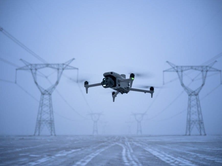
Dylan holds FAA Part 107 certification and operates a DJI Matrice 4T with Emlid RTK positioning, processing through Pix4D, DroneDeploy, and thermal analysis software.
Equipment
Survey-grade hardware, professional-grade software.
- DJI Matrice 4TMulti-sensor enterprise sUAS — wide RGB, medium-tele RGB, thermal, and laser rangefinder in a single payload. Used for every flight tier.
- Emlid Reach RS2+ RTK baseSub-cm RTK positioning for Survey Support tier and any engagement that requires GCP-verified accuracy.
- Pix4D Mapper + CloudPhotogrammetric processing, orthomosaic + DSM + 3D mesh + point-cloud generation. Pix4D-verified deliverables.
- Aetheris Portal + PipelineOur own software for proposal generation, scoring, delivery, invoicing, and client access. Built so a single operator can run an enterprise-grade pipeline.
Coverage
Serving the Midwest — based in Southwest Missouri.
Our primary coverage radius keeps us within a one-day return trip from base for routine work. Multi-site programs and out-of-region engagements quoted with travel costs included.