

Aerial data intelligence · Serving the Midwest
 Aerial data intelligence · Serving the Midwest
Decision-grade data. Captured from the air.
Aetheris turns a single flight into records you can decide from — roof moisture surveys, aerial site maps, volumetrics, change detection — georeferenced, measured, and built to hold up when the decision matters. A data partner, not a drone service.
FAA Part 107, night-operations compliant · OSHA 30 certified · RTK survey-grade positioning · Fully insured
What we do
One flight. The answers a decision needs.
Most sites raise more than one question — and the answers usually live in a phone photo, a memory, or a guess. Aetheris turns a single aerial pass into a record precise enough to build a decision on, whatever the site is.
Roof Moisture
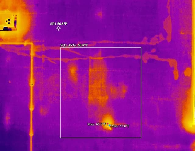
Infrared surveys to ASTM C1153-23 that map trapped water before you re-roof.
Site Intelligence
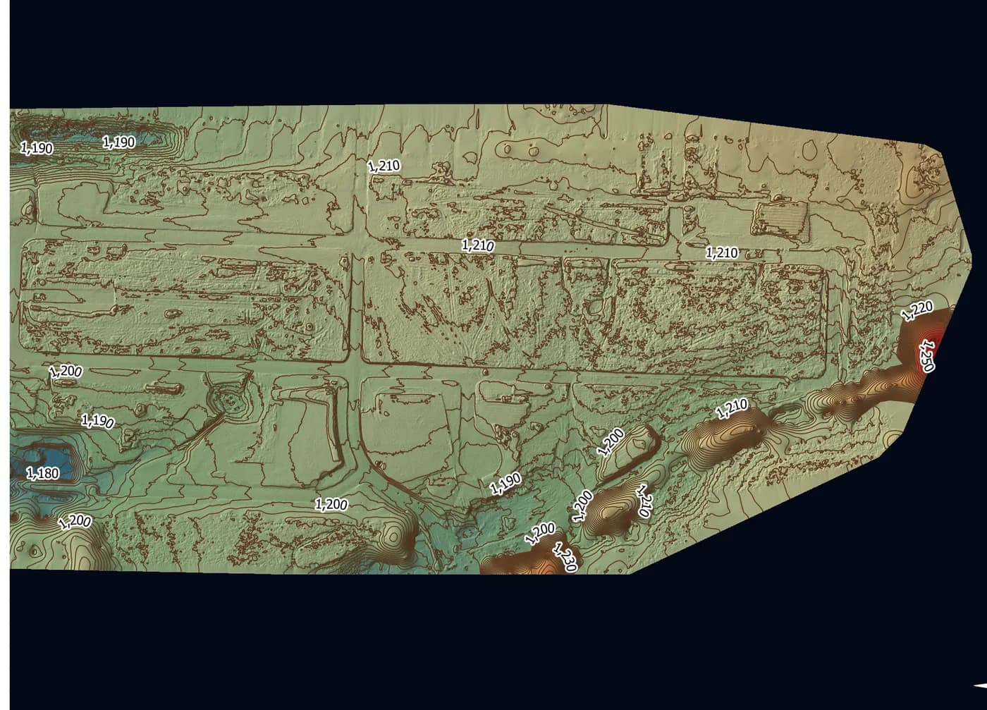
Progress documentation, as-built mapping, and change detection across the life of a project.
Volumetrics & Earthwork
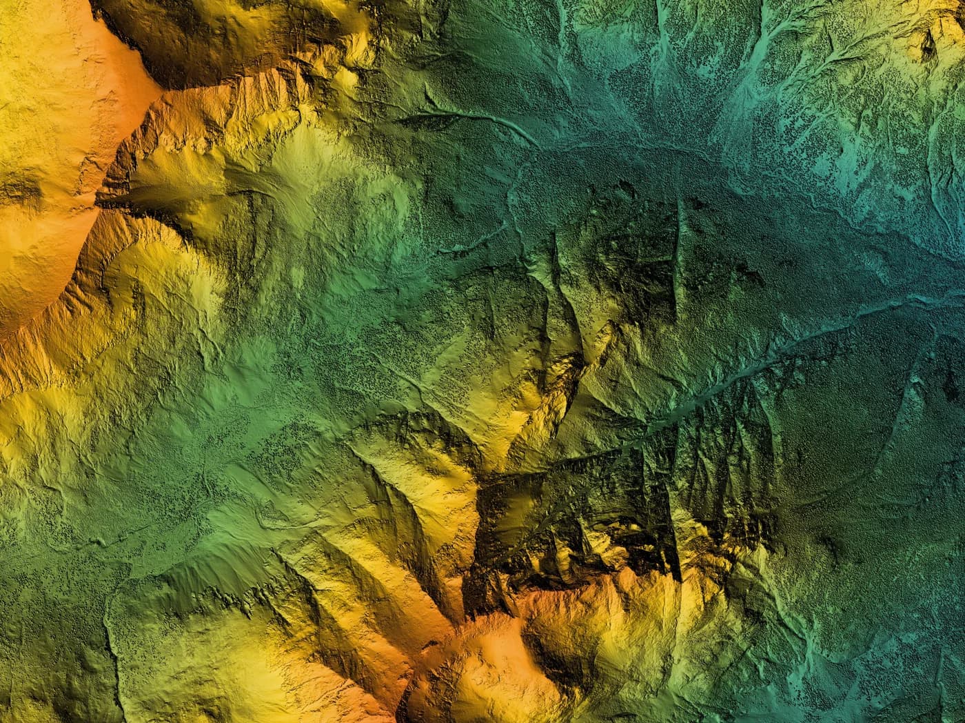
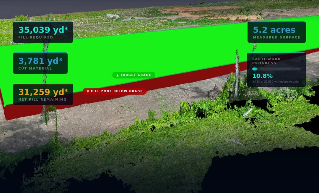
Cut/fill and stockpile measurement from survey-grade aerial data.
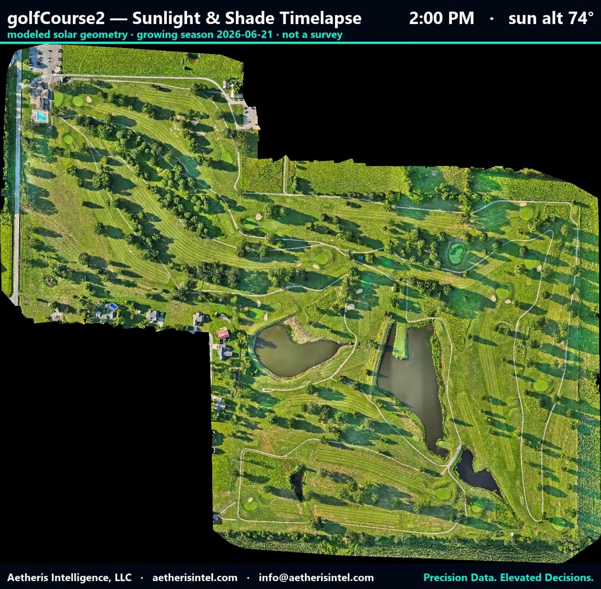
Planning & Decision Data
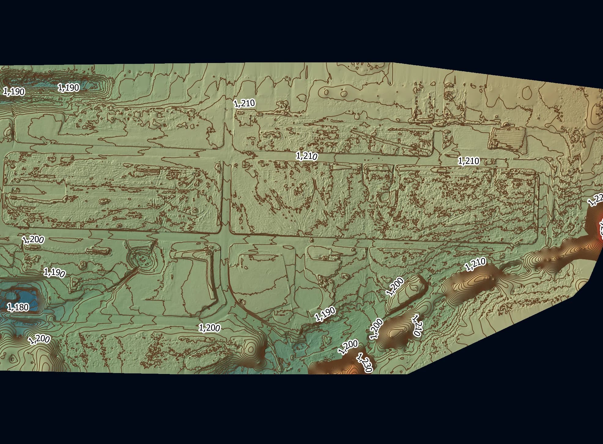
Terrain, drainage, and condition data that turns a property into a plan — from course management to capital projects.
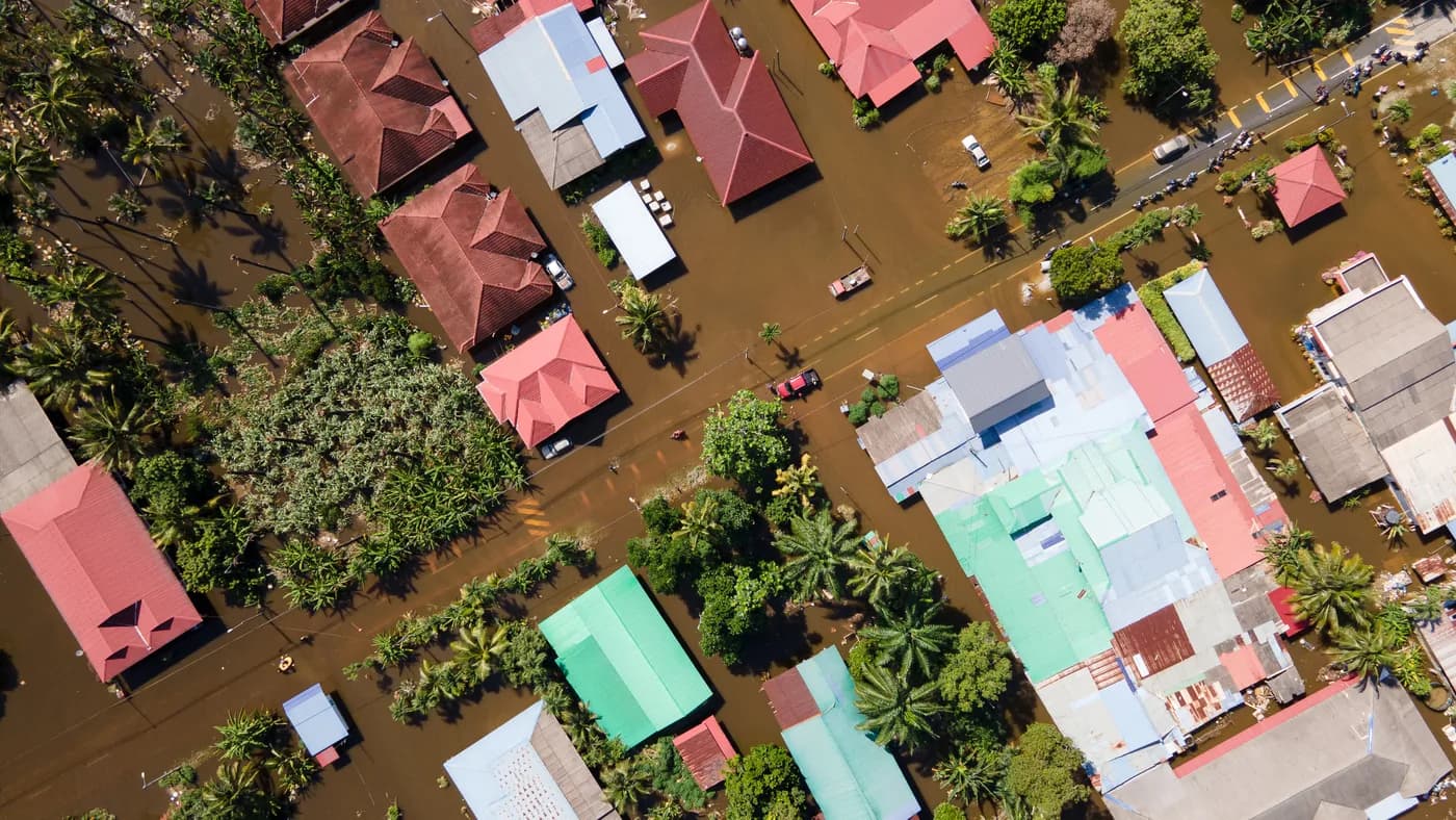
Rapid Response
Fast aerial deployment for storm damage, emergency assessment, and time-sensitive documentation when a decision can't wait.
Measurements are approximate — for screening, planning, and prioritization, verified against ground control where survey-grade precision is required.
Roof Moisture
Bid it right. Warranty it with proof.
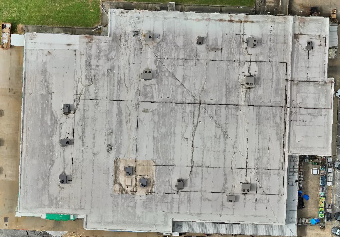
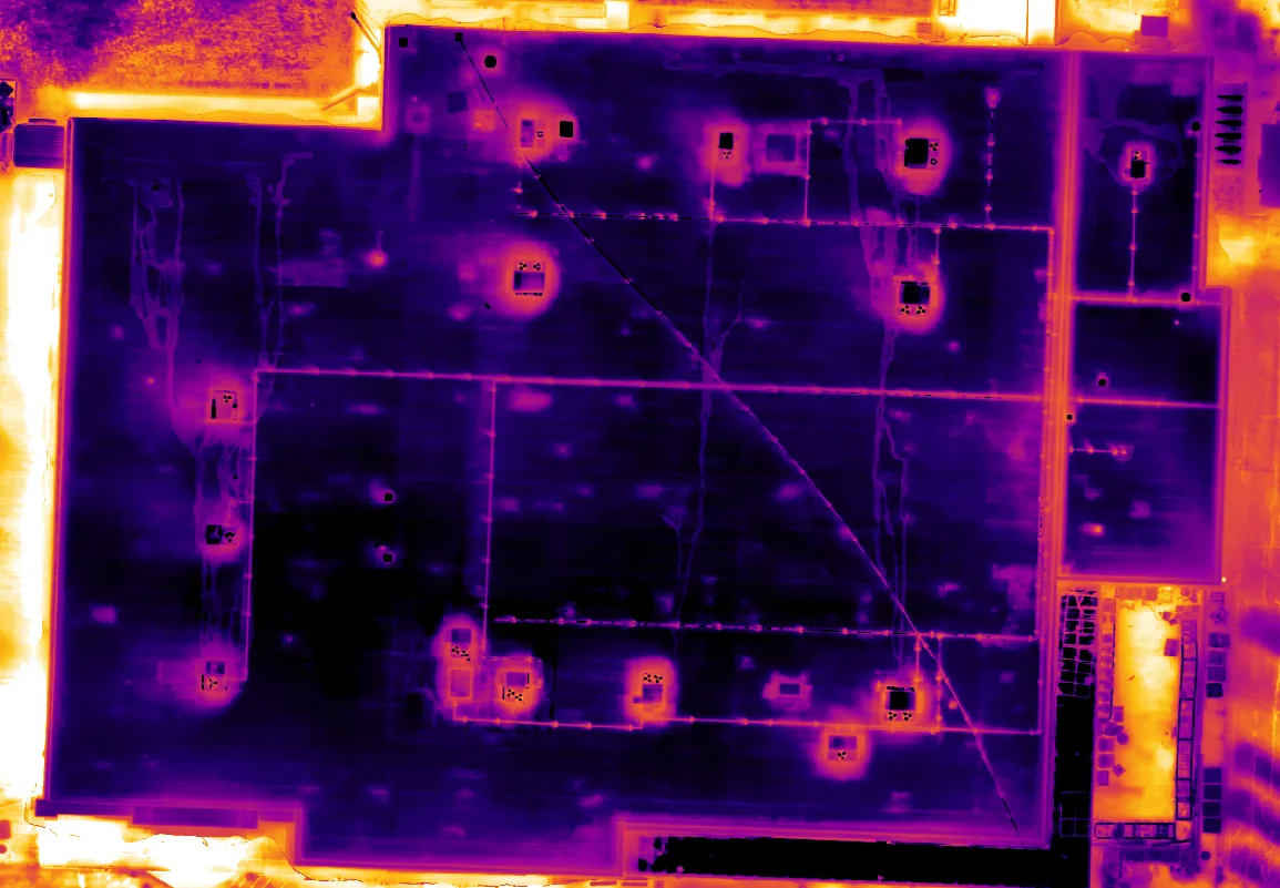
Every tear-off bid and every warranty callback comes down to the same question: how much of this roof is actually wet? Bid it high and you lose the job to someone who guessed lower. Bid it low and you eat the change order. Warranty a roof over saturated insulation and you’ll be back on it in two years on your own dime.
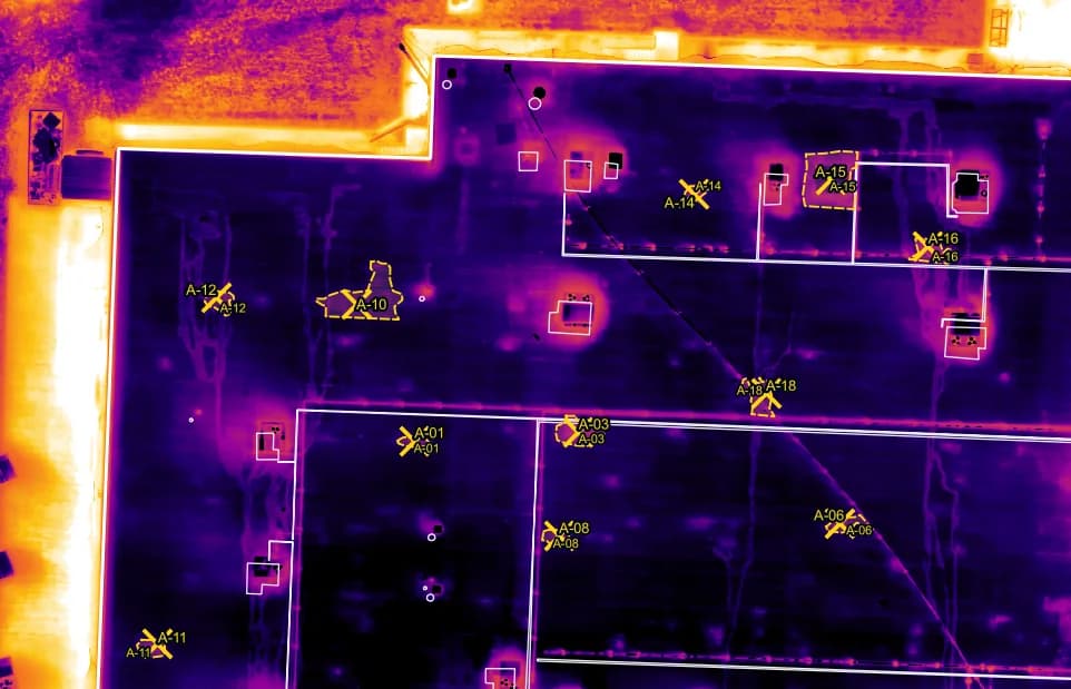
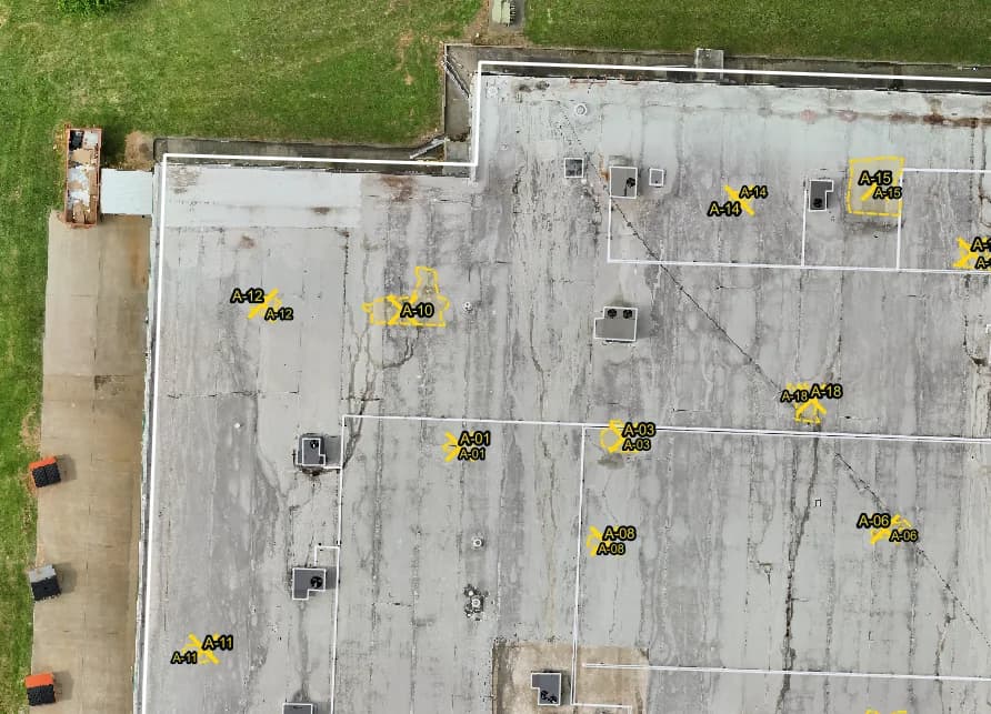
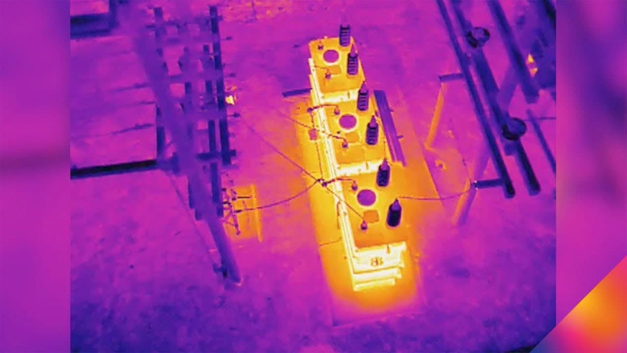
Aetheris flies the entire roof after sunset, when wet insulation gives itself away — it holds the day’s heat longer than the dry field around it, and a radiometric thermal sensor resolves that difference at 640×512. What comes back isn’t a handful of hot-spot photos. It’s a full thermal roof map to ASTM C1153-23: sub-centimeter resolution, RTK-positioned and geo-referenced, delivered CAD-ready so it drops straight into your estimating workflow.
It’s faster than walking 200,000 square feet with a handheld thermal camera, and nobody’s on the roof at night to do it. And when you hand an owner or an adjuster a measured moisture map alongside your bid, you’re not the third contractor with a clipboard — you’re the only one with evidence.
Every deliverable is built around how your business actually works: the formats your estimators use, the detail your PMs need, the documentation your warranty file requires.
Tear-off bids
Price from measured wet area, not a walk-around estimate
Warranty defense
Documented roof condition, dated and geo-referenced
Storm response
Whole-roof damage documentation in a single flight
CAD-ready output
Geo-referenced files that drop into your workflow
Targeted coring
We mark where to core; no cores until you know where
Nobody on the roof
No crew at height, no access disruption, no liability
Your Report
Site Intelligence
The record that keeps up with the job.
Ground gets moved, work gets covered, schedules slip — and the documentation is usually a phone photo and a memory. Aetheris gives a project a data record instead: an aerial site map at each milestone, earthwork volumes you can bill and verify, and change detection that shows exactly what moved between two dates.
For GCs, facility teams, municipalities, and owners, it’s the difference between remembering what happened on site and proving it — from the same flight that answers everything else.
Volumes and measurements are approximate — for planning and verification, confirmed against ground control where required.
How we’re equipped
Built to a standard you can defend.
Aerial data is only worth as much as its rigor. Every Aetheris flight is positioned with RTK for survey-grade accuracy, flown under FAA Part 107 with night-operations currency, and processed through our own in-house analytics and reporting pipeline — not a black-box third party. Our thermal work follows ASTM C1153-23, and our mapping and volumetrics are RTK-positioned and survey-grade, with ground control applied where the project calls for it. When the data has to hold up — in a bid, a claim, or a capital decision — the methodology behind it is the point.
What you get
Data solutions for every decision.
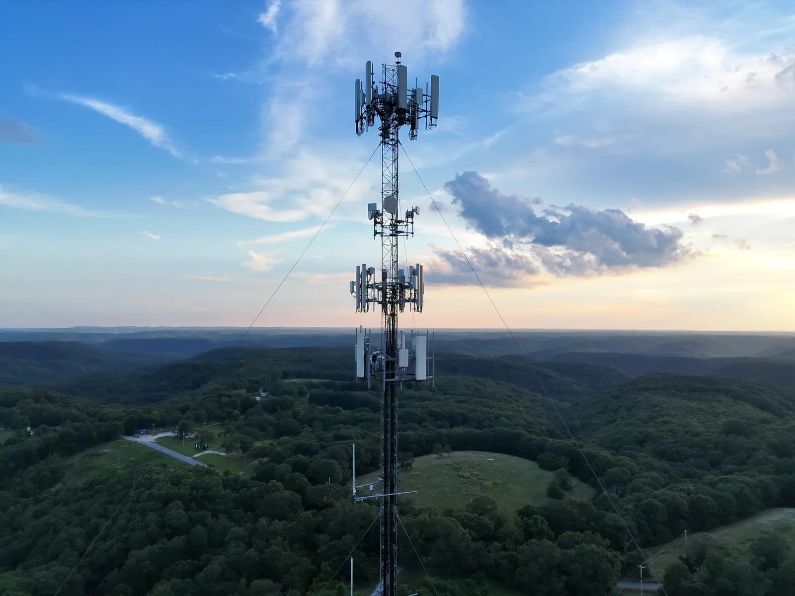
Every job ships with the right mix — thermal, dimensional, visual — built around the decision you’re making, not a package you don’t need.
Industries Served
One platform. Every aerial workflow.
How it works
Five steps, from request to report.
- 01Request
Submit project details and a preferred date through the portal. We confirm the flight window within one business day.
- 02Fly
We fly the site (FAA Part 107 certified, fully insured). Typical flight is 30–60 minutes; no need for you to be on site.
- 03Process
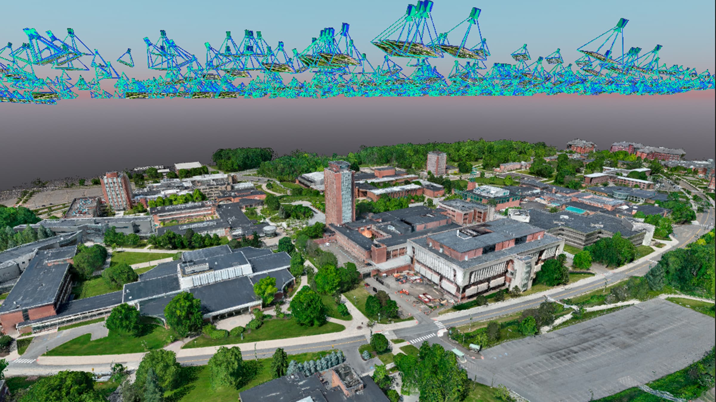
Photogrammetric workup in Pix4D — ortho, 3D mesh, DSM, point cloud. Annotations classified and measured automatically.
- 04Deliver
Branded PDF report, downloadable deliverables, and an online invoice — delivered through your client portal.
- 05Analyze
Available with subscription — multi-date trend analysis and change detection that compounds with every flight.
Available with subscription
Independent Research
Research & Case Studies
Public-agency programs and peer-reviewed studies validating UAV photogrammetry for construction earthwork, volumetrics, and infrastructure inspection — independent of any vendor claim.

Ready to fly?
Submit a service request through the portal, or reach out directly. Typical response: same business day.
- Phone
- 417-342-1553
- info@aetherisintel.com
- Coverage
- SW Missouri & NW Arkansas — further on request
- Licensing
- FAA Part 107 certified · Fully insured