
Precision data for every decision your course depends on.
We turn your course into survey-grade intelligence your team can act on — where water and chemicals are wasted, which greens are shade-starved, where turf is under stress, and exactly what a renovation will touch. It’s the data behind tighter budgets, smarter planning, and better conditions.
You can’t budget what you haven’t measured. We measure all of it.
Built for the people who run the course.
Three deliverables that turn your property into decisions — what to spend, where to fix, and how to plan — each backed by measured data.
Aerial maps and measurements are approximate and for planning — not a boundary survey or legal area certification.
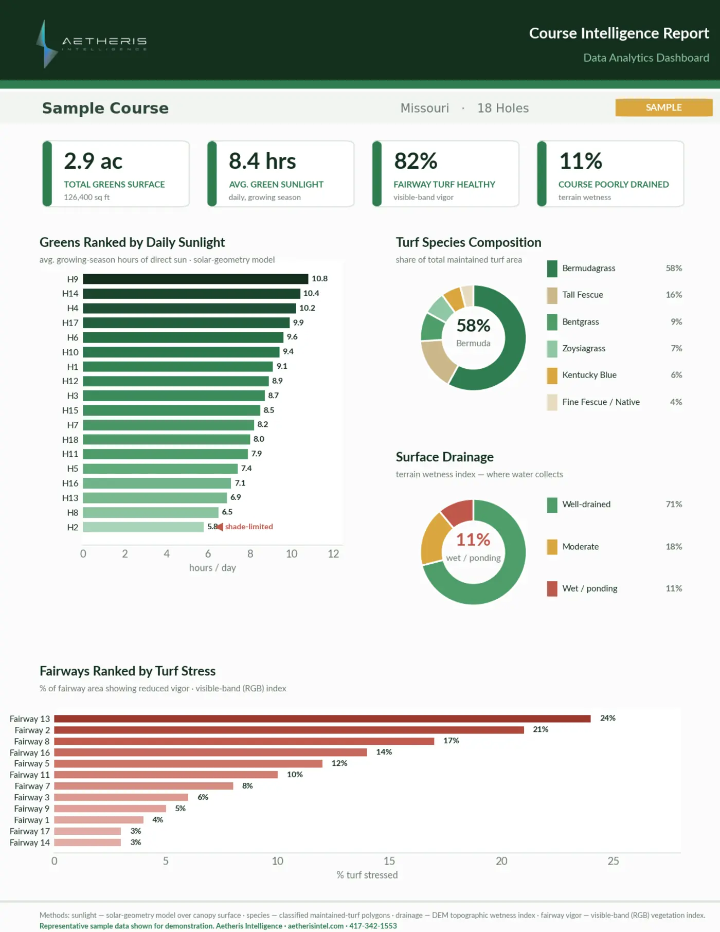
The deliverables your team works from.
Large-format course blueprints and a full conditions readout — georeferenced, centimeter-accurate, and tagged to the decisions they drive.
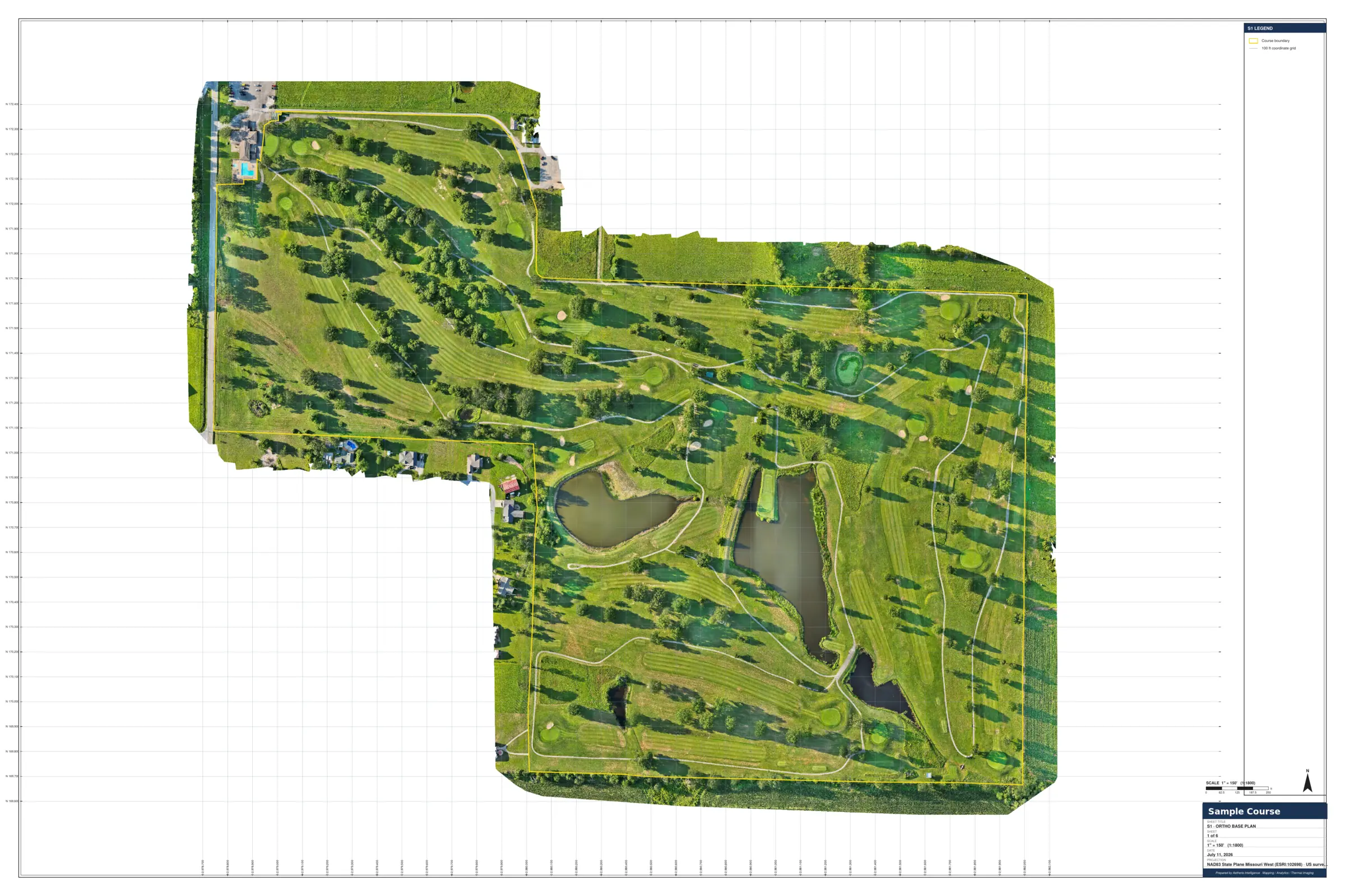
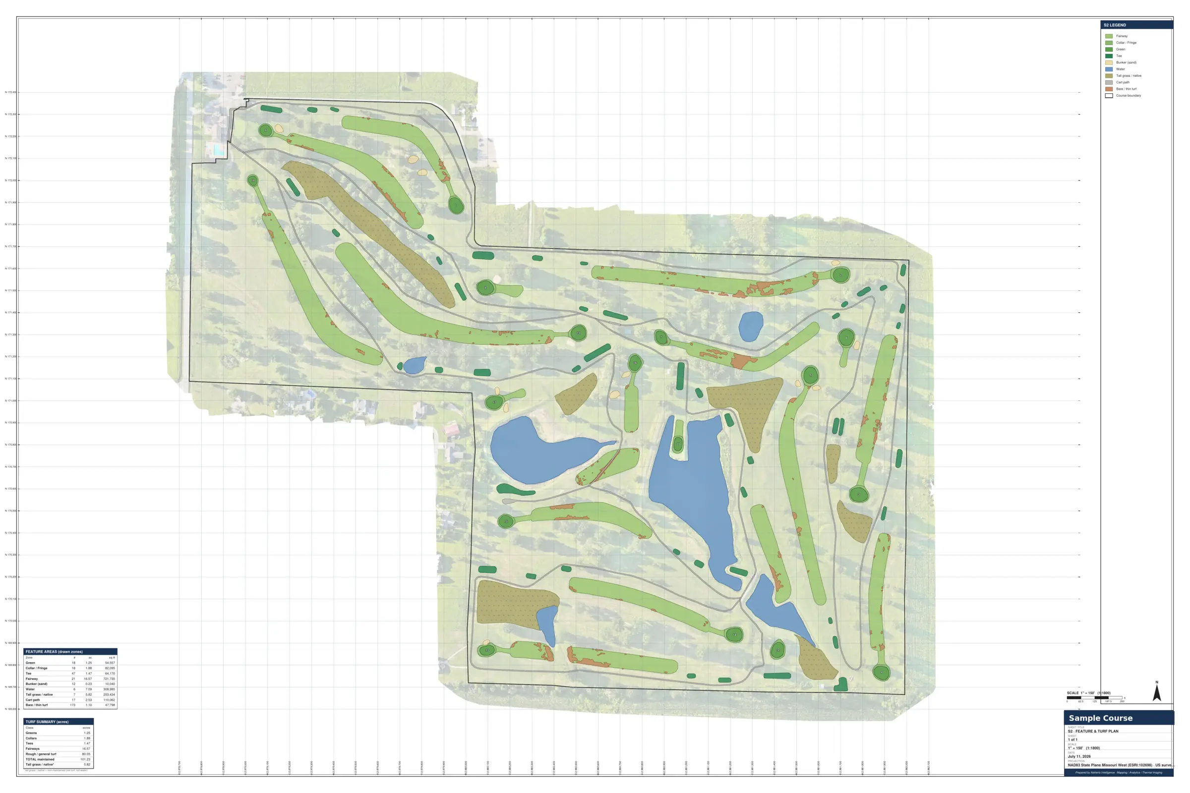
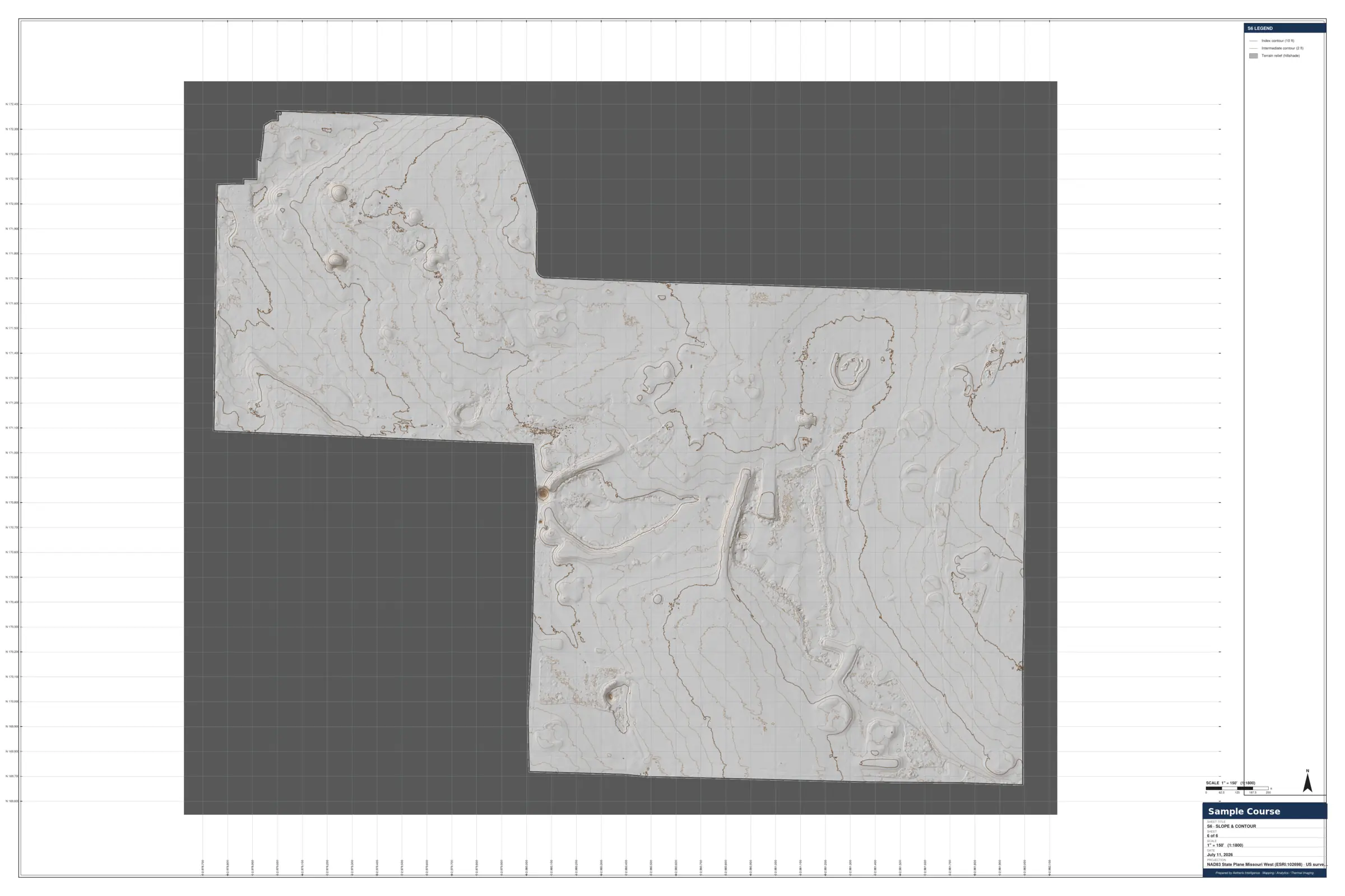
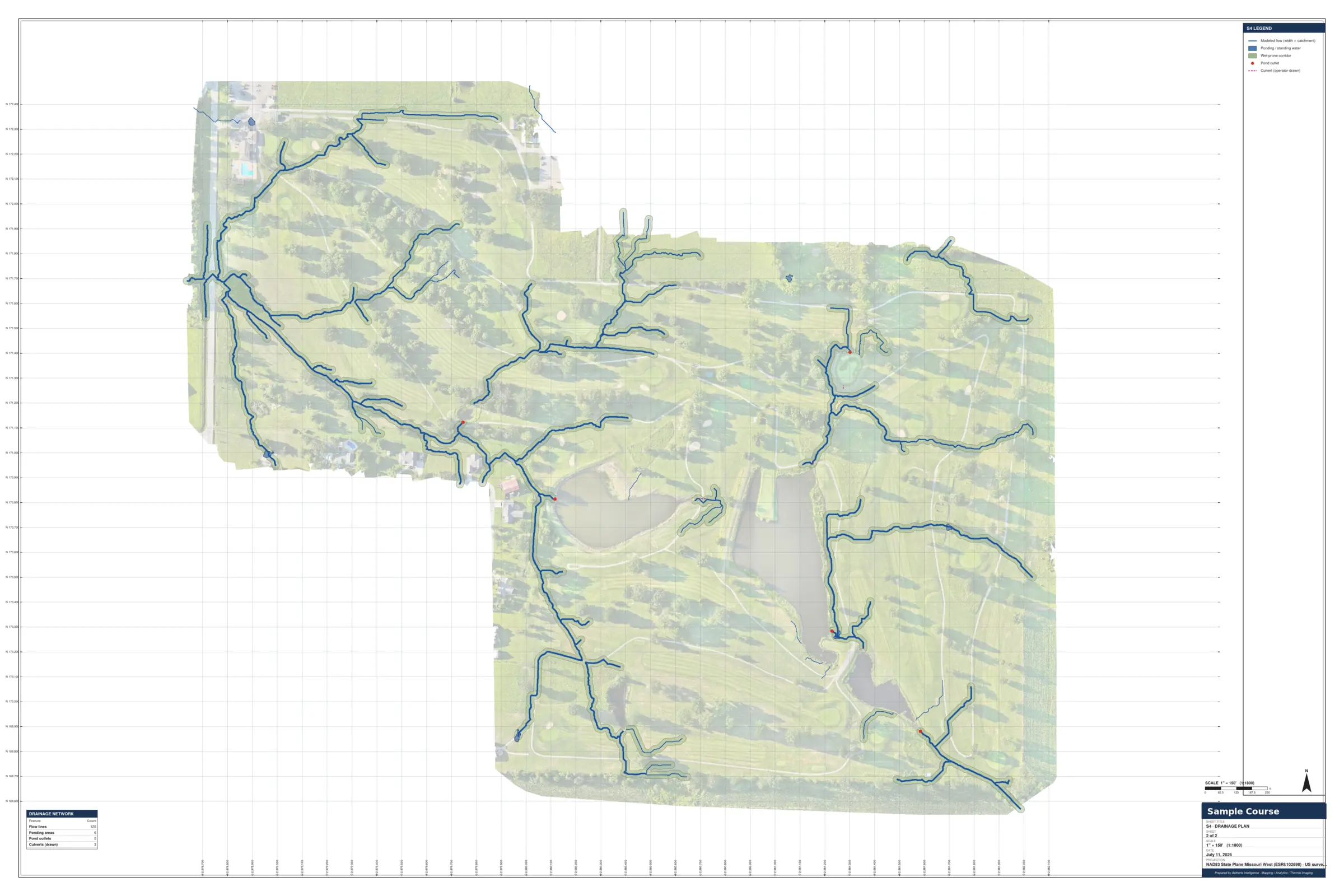
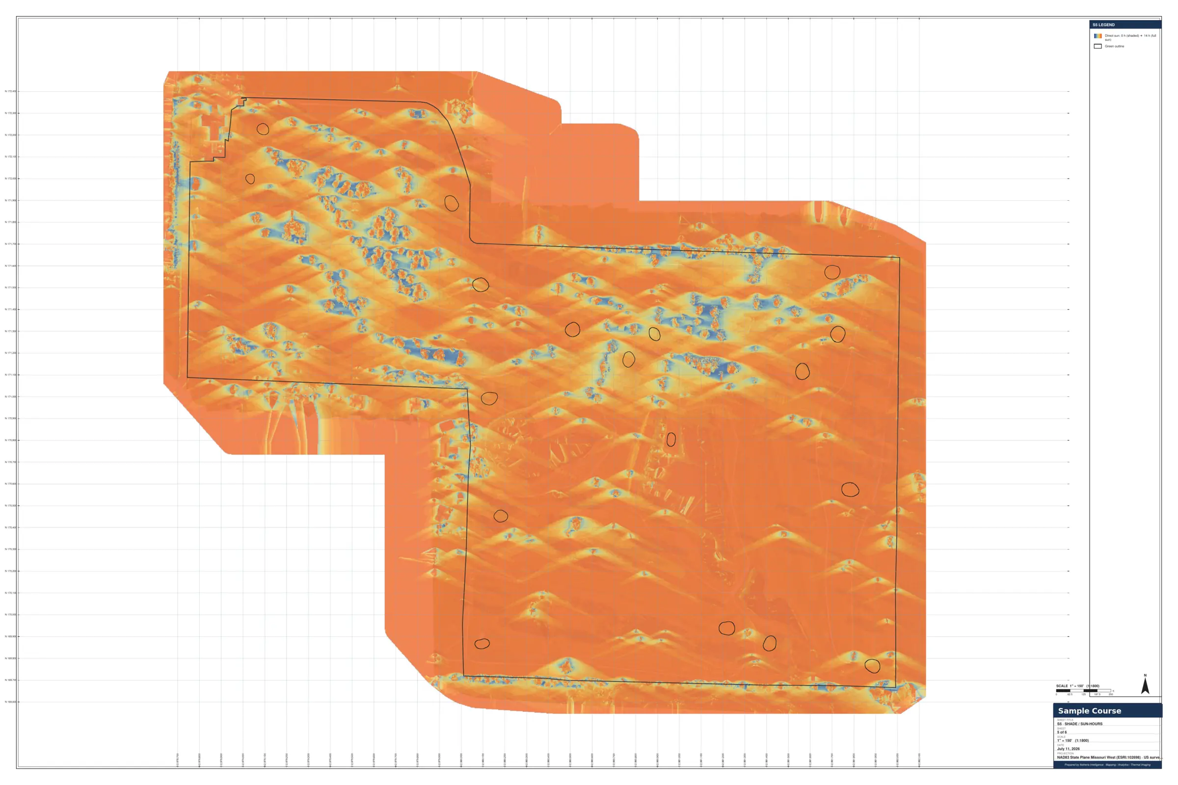
Additional layers available — tree/canopy, irrigation as-built, turf-stress. Delivered large-format printed + CAD-ready DWG/DXF.
The course distilled into the numbers that drive agronomy, budgeting, and renovation — acreage, drainage, sun-hours, and turf stress in one readout.
Representative deliverables. Approximate — not a boundary survey.
One survey. Choose how you keep it.
Par for the Course is a one-off; Birdie and Eagle keep it current season after season — our Living Data program. Scoped and quoted per course.
- Single survey flight (one-off)
- Conditions Report — acreage, drainage, sun-hours, turf stress
- Course Blueprints — large-format, georeferenced, 1–3 cm
- Greens book + 3D greens (funded by local sponsors)
- Everything in Par for the Course
- Annual recapture + year-over-year change detection
- Book, data & media kept current
- Priority scheduling
- Everything in Birdie Package
- Seasonal recapture — 4×/year
- Seasonal change detection + condition trends
- Pre- & post-project flights
Multi-course or club-group program? Volume pricing available.
Run your course on data.
Tell us the course. We handle the airspace, the capture, and the build — and deliver the Conditions Report, Course Blueprints, and greens book to your portal, ready to plan and budget from.
Aerial maps, green contours, yardages, terrain, and acreage are approximate and for course planning, maintenance, and play — not a survey, boundary determination, or legal area certification. Aetheris Intelligence, LLC operates under FAA Part 107.