
Aetheris Atlas — golf course base map
When a renovation, an irrigation project or a board question comes up, the first thing anyone needs is a reliable map of the course. Aetheris Atlas is the base map of your course: a set of large-format course blueprints, 3 ft × 2 ft, with the aerial site map, every feature drawn, contours and drainage flow, kept as the one map every project starts from.

Slide from the aerial map to the layers drawn from it.
Every Atlas layer is drawn on the same ground as the aerial map. Drag to compare a course's aerial with its feature map, then with its drainage flow.
Who works from the sheets?
Plan irrigation, drainage and renovation work from the same sheets.
Sheets to bring to board meetings and planning meetings.
The sheets, and the same map on screen.
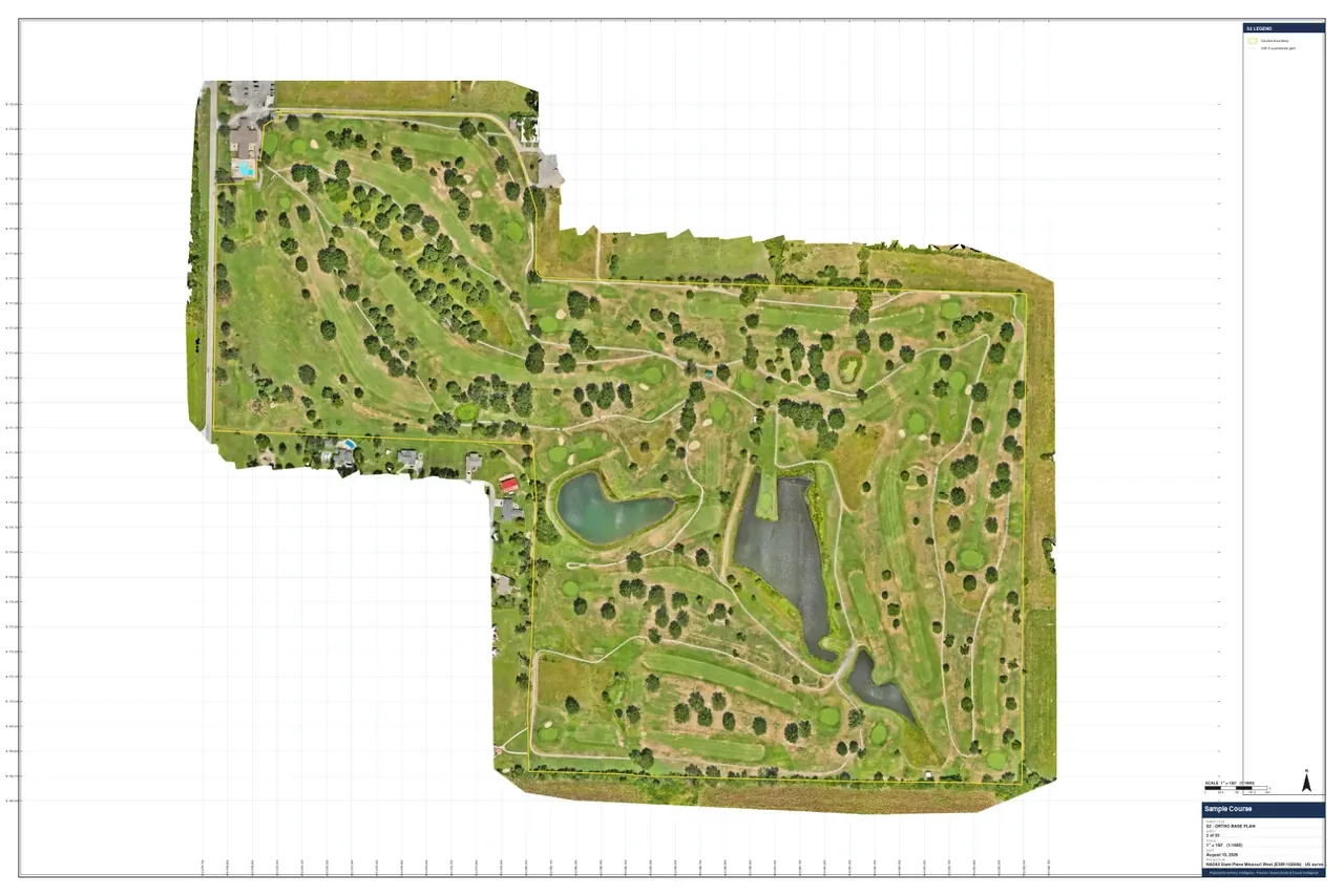
Aerial site map
The whole course from the drone survey, printed large.
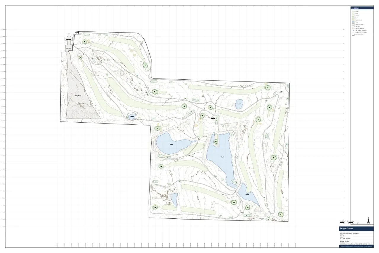
Course features
Greens, tees, fairways, bunkers and water, every feature drawn on the aerial site map. With the area of each surface, the free seed and topdressing calculators give the quantities.
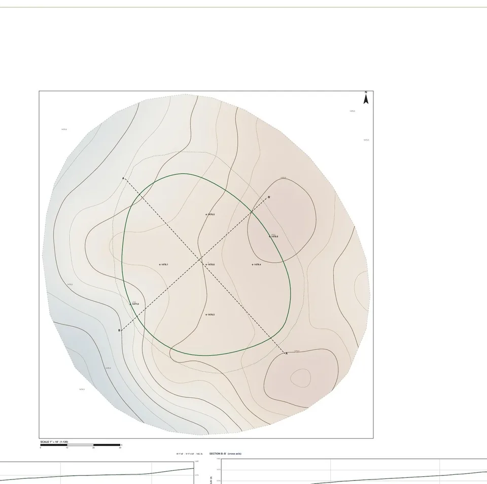
Contours
Contours from the survey's terrain model.
Drainage flow
Where water collects and runs off, modeled from the terrain.
Live map layers in Cortex
The same layers on screen in Cortex, so the sheets and the software show the same course.
What's in a course's Atlas set?
This set was drawn from an August 2026 survey and printed at a scale of 1 inch = 150 feet. Each sheet carries its own legend, scale bar and north arrow.
- Aerial base plan: the whole course, stitched from 1,703 overlapping aerial photos, with the course boundary drawn.
- Feature and turf plan: every green, tee, fairway, bunker and water body drawn, with the area of each type. On this course that is 18 greens (1.25 acres), 47 tees (1.47 acres), 21 fairways (16.57 acres) and 12 bunkers. Areas are approximate.
- The same sheet lists the grass on each surface: creeping bentgrass greens and collars, Kentucky bluegrass tees and fairways, and tall fescue rough.
- Contour sheet: contours from the survey's terrain model.
- Drainage plan: modeled water-flow lines across the course, with 10 ponding areas and 3 culverts drawn in.
- The light on each green comes from the shade analysis, printed as shade maps on the same base.
A client course · Captured August 2026 · DJI Matrice 4T RGB · Sheets dated August 10, 2026, at 1 in = 150 ft.
From a survey flight to the sheets on the table.
Survey flight
We fly the course by drone.
Aerial site map and terrain model
The flight is stitched into an aerial site map and a model of the ground.
Features, contours and drainage
Every feature is drawn, and the contours and drainage flow come from the terrain model.
Print and screen
Large-format sheets for the meeting table, and live map layers in Cortex.
Questions about Atlas
What is a golf course base map?
A golf course base map is one map of the whole course that every project starts from: the aerial site map, the features, the contours and the drainage. Aetheris Atlas delivers it as large-format sheets and live layers in Cortex.
What size are the sheets?
Aetheris Atlas sheets are large-format, 3 ft × 2 ft.
Is Atlas a survey?
No. Aetheris Atlas is for planning and managing the course, not a boundary or construction survey.
Where does the map come from?
The Aetheris Atlas map comes from our own drone survey of your course, flown with a DJI Matrice 4T and positioned with an Emlid RS2+ RTK receiver.
Can we see Atlas on screen?
Yes. The Aetheris Atlas layers are live in Cortex, so the sheets and the software show the same course.
What does the feature and turf plan show?
The Aetheris Atlas feature and turf plan shows every green, tee, fairway, bunker and water body drawn on the aerial map, with the approximate area of each type and the grass on each surface.
Are the Atlas areas and contours exact?
No. Aetheris Atlas areas and contours come from the drone survey's terrain model and are approximate, for planning and managing the course.